Airborne Geophysical Survey
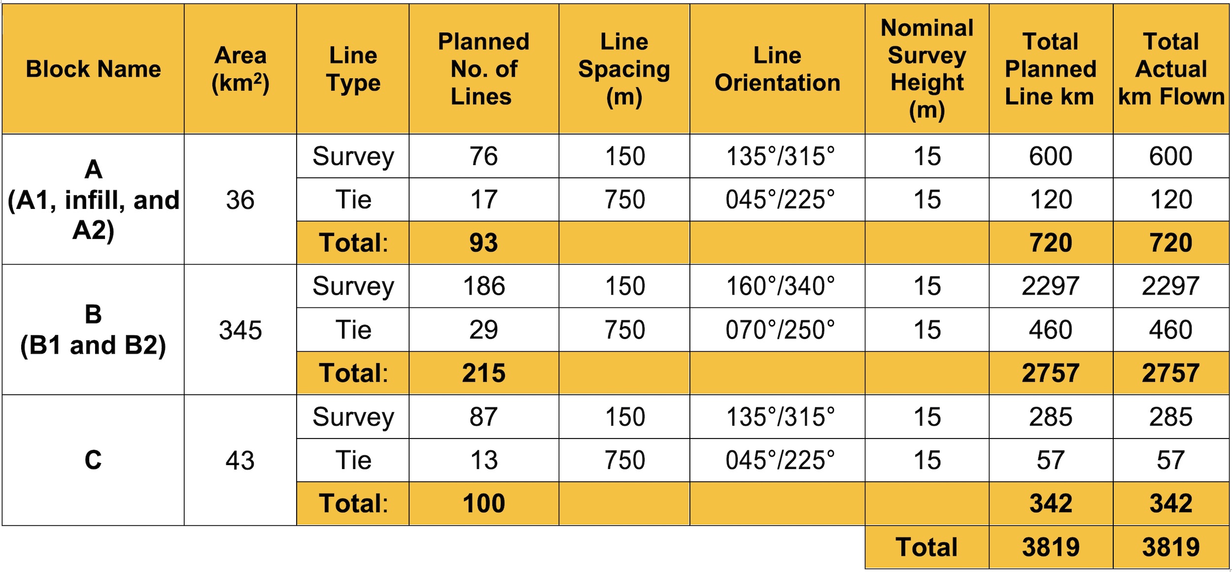
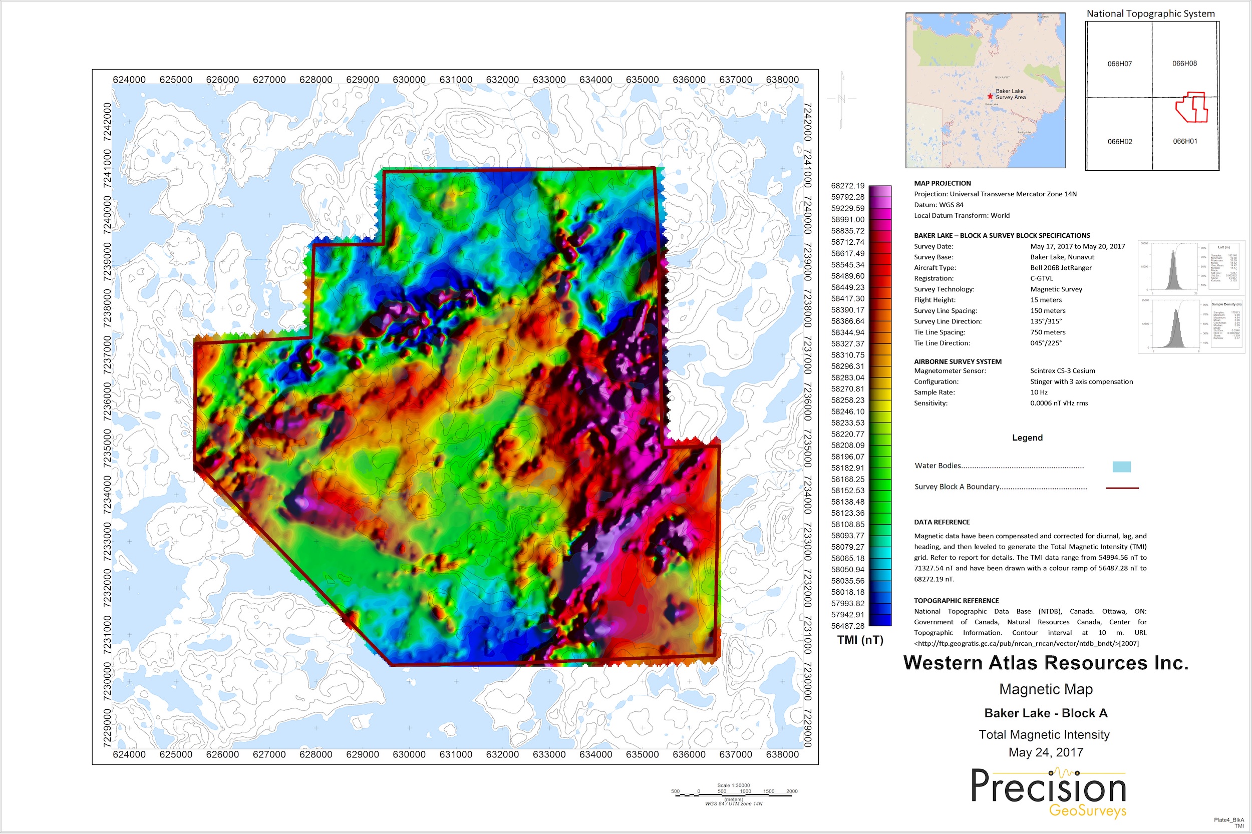
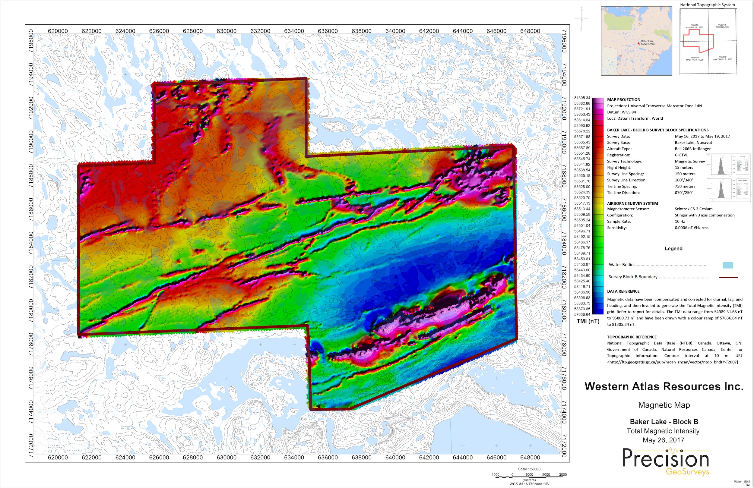
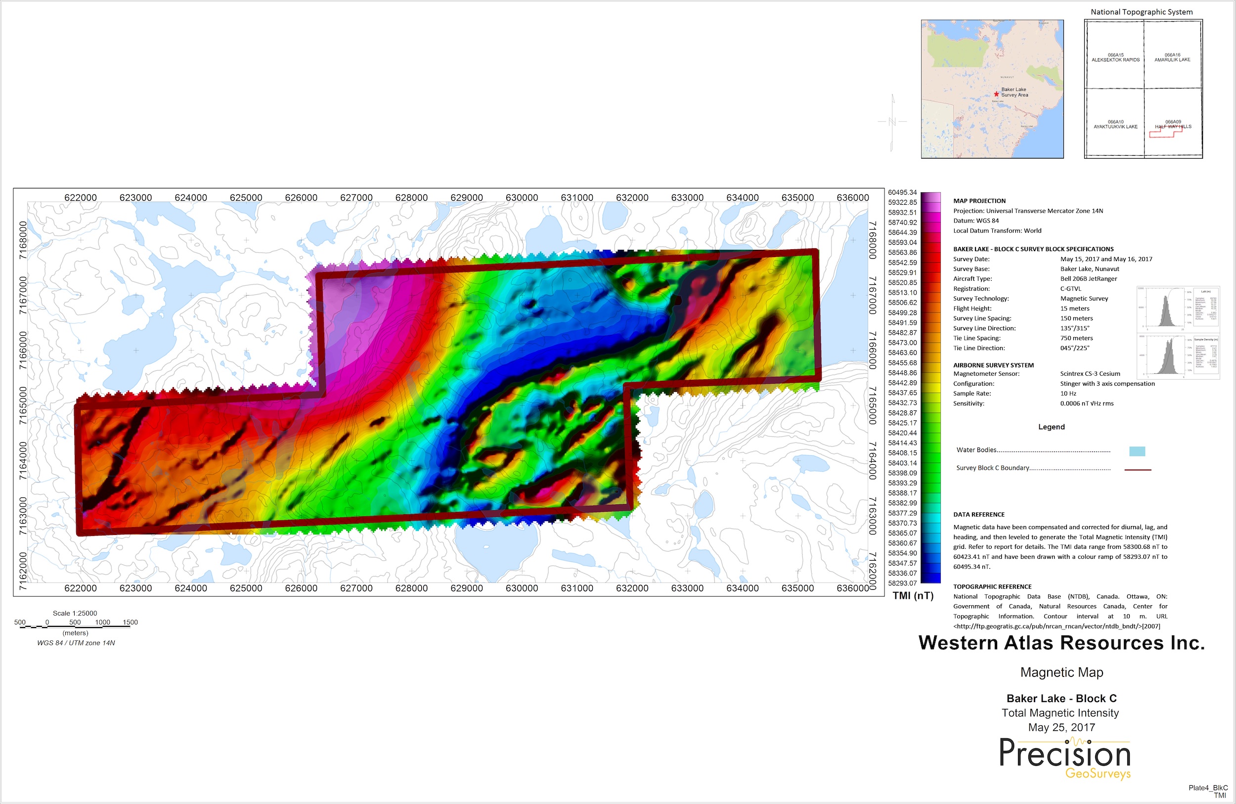
The high-resolution helicopter-borne magnetic survey is comprised of three survey blocks: A, B, and C. A total of 3,819-line km of data was collected on 367 survey lines and 62 tie lines over the three survey blocks. For all survey blocks survey lines were flown at 150 meters spacing with tie lines at 750 meters spacing flown normal to survey lines. The survey was flown at a constant flight height of 15 meters above ground.


